

Digital Mapping
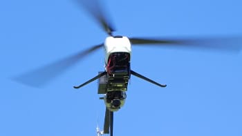
UAS-based solutions provide unparalleled maneuverability and precision for quickly creating 3-D terrain models or objects. Using a solution from an UAS, as compared to a satellite or manned aircraft, allows measurements that can be taken much closer to the object being studied.
SempMira uses unmanned aircraft systems (UAS), sensors and software to provide the farmer with the processable information they need to quickly and accurately assess crop health. For small and medium-sized producers, the cost of acquiring the data provided by our services is typically much less than that available for manned aircraft or satellite-based imagery, while providing much higher resolution as the basis for their Decisions.
Construction Monitoring
The use of UAV is an indispensable tool to monitor constructions, increasing the precision and speed in the work. This technology allows accuracy up to 8mm, which is 3 times greater than the required industry precision (20mm). Generating 3D models with millimetric precision is an unprecedented technological advance, with the assistance of high definition cameras and specialized software it is possible to analyze surfaces up to 1mm per pixel. The inspection time of a work can be considerably reduced, up to 500%, depending on the conditions of the same..